Physical Address
304 North Cardinal St.
Dorchester Center, MA 02124
Physical Address
304 North Cardinal St.
Dorchester Center, MA 02124
This is AI generated summarization, which may have errors. For context, always refer to the full article.
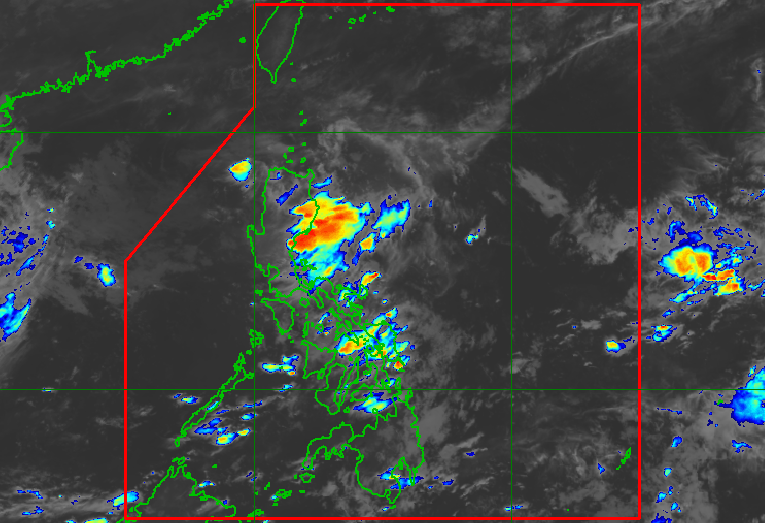
The low pressure area that used to be Tropical Depression Fabian is moving farther away from the Philippine Area of Responsibility on Saturday, August 9. PAGASA also continues to monitor Tropical Storm Podul outside PAR.
MANILA, Philippines – Tropical Depression Fabian left the Philippine Area of Responsibility (PAR) at 1 am on Saturday, August 9, then weakened into a low pressure area (LPA) at 2 am.
The Philippine Atmospheric, Geophysical, and Astronomical Services Administration (PAGASA) said the remnant low that used to be Fabian was located 365 kilometers west of Laoag City, Ilocos Norte, as of 4 am.
It is slowly moving west northwest, or away from PAR, and has no more effect on the coastal waters of Northern Luzon.
Fabian had developed at 8 am on Friday, August 8. It did not bring rain as a tropical cyclone, and tropical cyclone wind signals were not raised.
But it did trigger heavy rain when it crossed Northern Luzon as an LPA last Thursday, August 7.
Fabian was the Philippines’ sixth tropical cyclone for 2025, and the first for August.

The country could soon have its seventh tropical cyclone for the year, as Podul could enter PAR between late Sunday evening, August 10, and early Monday morning, August 11.
Podul, currently a tropical storm outside PAR, was last spotted 2,230 kilometers east of extreme Northern Luzon at 3 am on Saturday. It is moving west northwest at 15 kilometers per hour (km/h).
So far, Podul has maximum sustained winds of 85 km/h and gustiness of up to 105 km/h. But PAGASA said it may strengthen into a severe tropical storm on Saturday morning and possibly into a typhoon by Sunday, before its entry into PAR.
Once it enters PAR, it would be given the local name Gorio.
The weather bureau had also said in a separate advisory at 11 pm on Friday that Podul or the potential Gorio “is less likely to directly affect the weather and sea conditions in the country within the next five days.” It could just stay near the PAR northern boundary.

But for Monday to Wednesday, August 13, there is still “large uncertainty” in Podul’s projected track and intensity.
“Any northward or southward shift in the track forecast will significantly change the intensity forecast for Monday to Wednesday,” added PAGASA.
If Podul shifts southward, it could also affect extreme Northern Luzon, according to PAGASA Weather Specialist Grace Castañeda.
The weather bureau previously estimated that two or three tropical cyclones could develop within or enter PAR in August.
On Saturday, the southwest monsoon or habagat will continue to affect the country.
Mimaropa, Bicol, Quezon, and Western Visayas are expected to see scattered rain and thunderstorms, while the rest of the country may have isolated rain showers or thunderstorms due to the southwest monsoon. – Rappler.com