Physical Address
304 North Cardinal St.
Dorchester Center, MA 02124
Physical Address
304 North Cardinal St.
Dorchester Center, MA 02124
This is AI generated summarization, which may have errors. For context, always refer to the full article.
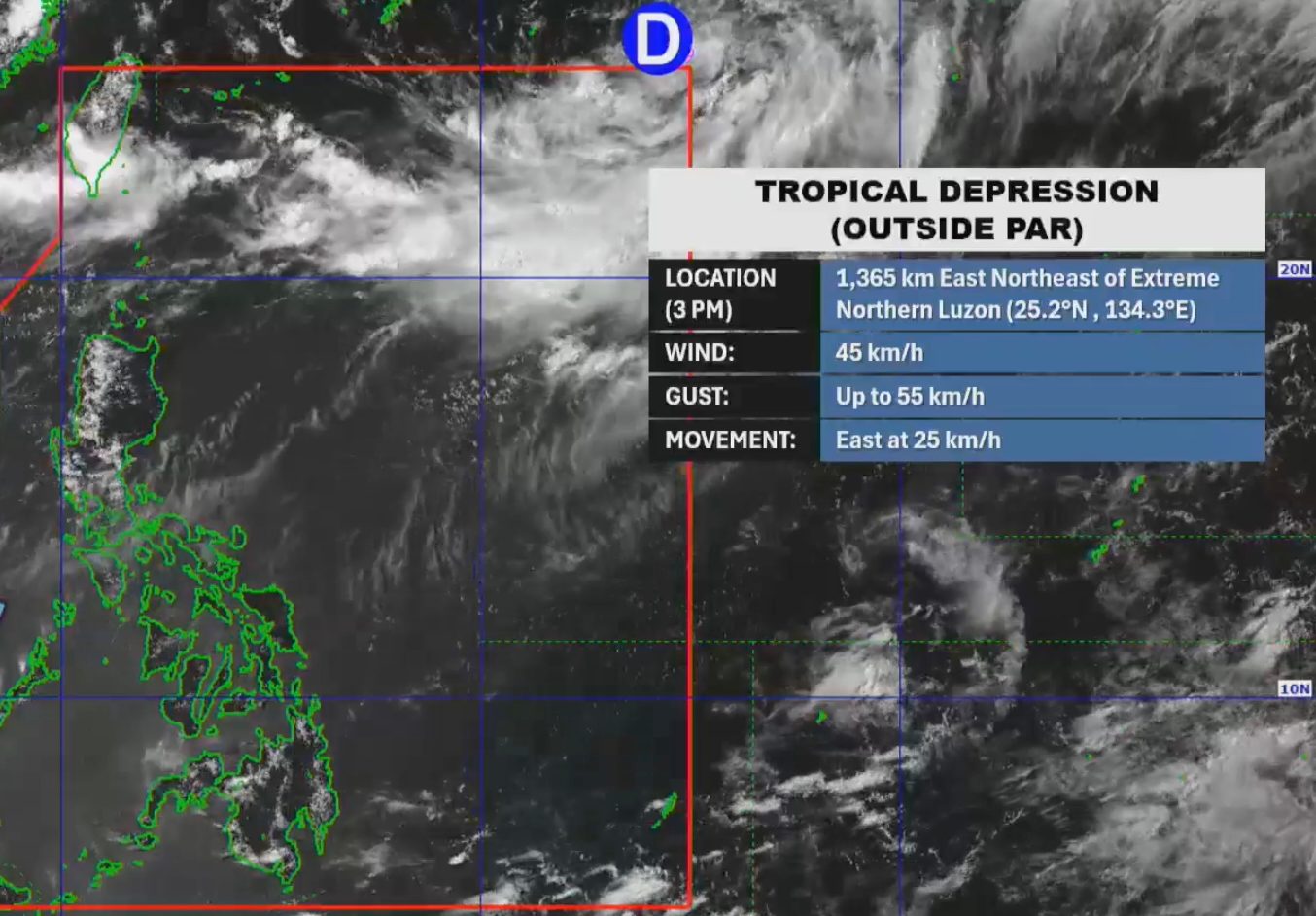
The tropical depression outside the Philippine Area of Responsibility on Friday, August 1, has no direct effect on the country and is not enhancing the southwest monsoon
MANILA, Philippines – A low pressure area outside the Philippine Area of Responsibility (PAR) developed into a tropical depression at 2 pm on Friday, August 1.
As of 3 pm, the newly formed tropical depression was located 1,365 kilometers east northeast of extreme Northern Luzon, moving east at 25 kilometers per hour (km/h).
It has maximum sustained winds of 45 km/h and gustiness of up to 55 km/h, according to the Philippine Atmospheric, Geophysical, and Astronomical Services Administration (PAGASA).
PAGASA Weather Specialist Benison Estareja said in a briefing on Friday afternoon that the tropical depression could head northeast by Saturday, August 2. This means it is unlikely to enter PAR.
The weather bureau expects two or three tropical cyclones to develop within or enter PAR in August. The next three local tropical cyclone names are Fabian, Gorio, and Huaning.
Estareja added that the tropical depression outside PAR is not directly affecting any part of the Philippines. It is also not enhancing the southwest monsoon or habagat, which is now weakening after wreaking havoc in recent weeks.
Until early Saturday, the southwest monsoon may still bring scattered rain and thunderstorms to Ilocos Norte, Ilocos Sur, Abra, Batanes, and Babuyan Islands. The rest of Luzon will have generally fair weather, with just isolated rain showers or thunderstorms, still due to the southwest monsoon.
The Visayas and Mindanao are not affected by the southwest monsoon and may only get localized thunderstorms. – Rappler.com