Physical Address
304 North Cardinal St.
Dorchester Center, MA 02124
Physical Address
304 North Cardinal St.
Dorchester Center, MA 02124
This is AI generated summarization, which may have errors. For context, always refer to the full article.
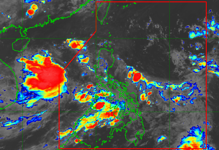
The new tropical depression, which formed early Tuesday, June 10, is not directly affecting the Philippines. But the enhanced southwest monsoon will bring more rain.
MANILA, Philippines – The low pressure area (LPA) being monitored in the past few days left the Philippine Area of Responsibility (PAR), then developed into a tropical depression at 2 am on Tuesday, June 10.
Since the LPA became a tropical depression outside PAR, it has not been given a local name. Meanwhile, international names are only given to tropical cyclones when they reach tropical storm category.
As of 3 am on Tuesday, the tropical depression was located 600 kilometers west southwest of Bacnotan, La Union, or 535 kilometers west of Iba, Zambales, moving southwest at 20 kilometers per hour (km/h).
The Philippine Atmospheric, Geophysical, and Astronomical Services Administration (PAGASA) said in its 4 am forecast that the tropical depression has maximum sustained winds of 45 km/h and gustiness of up to 55 km/h.
PAGASA Weather Specialist Chenel Dominguez said the weather bureau is not ruling out the possibility of the tropical depression entering PAR, but even if it does, it is not expected to have a direct impact.
The tropical depression is not directly affecting the Philippines. However, it is seen to enhance the southwest monsoon or habagat, which is the source of rain in Central Luzon, Southern Luzon, the Visayas, and Mindanao on Tuesday.
These will be the areas most affected by the southwest monsoon, based on PAGASA’s 5 am rainfall outlook for the next three days:
Tuesday, June 10
Wednesday, June 11
Thursday, June 12
For Tuesday, scattered rain and thunderstorms are likely in Metro Manila, Calabarzon, Bicol, and the Visayas, as well as other parts of Central Luzon and Mimaropa not mentioned in the outlook above. Mindanao will continue to have just isolated rain showers or thunderstorms.
PAGASA reminded affected areas to be on alert for possible floods and landslides.
The weather bureau earlier said one or two tropical cyclones are expected to form within or enter PAR in June. For the next six months, or from June to November, there could be 11 to 19 tropical cyclones.
The start of the rainy season was declared on June 2, while the southwest monsoon’s onset was announced on May 30. – Rappler.com